SatVu’s HotSat-1 archive available to US Government agencies via GDM

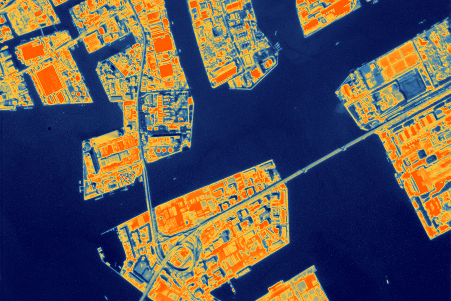
Above: Yokohama, Japan.
Courtesy SatVu
This pioneering pilot programme streamlines access to commercial space-based data, enabling US Government (USG) agencies to rapidly secure critical insights for Tactical Surveillance, Reconnaissance, and Tracking (TacSRT).
HotSat-1, the world’s first commercially available satellite capturing very high-resolution thermal infrared imagery, set a new benchmark for thermal intelligence during its operational period from June to December 2023.
SatVu’s advanced thermal imaging capabilities provide unmatched visibility, day and night, across more than 50 countries, equipping defence organisations with the intelligence needed to enhance strategic planning and mission execution.
As a vendor on the GDM, SatVu provides USG consumers with seamless access to its high-resolution thermal imagery. Later this year, the launch of HotSat-2 will further expand SatVu’s data archives, increasing the availability of critical insights.
Through the GDM, USG agencies can easily acquire SatVu’s data to monitor urban infrastructure, assess power plant efficiency, track wildfire activity, analyze volcanic events, and gain a deeper understanding of environmental changes with unparalleled precision.
SatVu CEO and Co-Founder, Anthony Baker, said: "The inclusion of the HotSat-1 archive in SSC’s Global Data Marketplace marks a significant milestone, giving users across defence, intelligence, and civilian sectors access to insights that were previously beyond reach. With our MWIR thermal imaging, users can capture the unseen.”
SatVu was founded to bring to market high frequency and commercially available high-resolution thermal imagery from space. After a period of research and development, in 2021 the company was awarded £1 million from the UK Space Agency’s National Space Innovation Programme to build the compact high-resolution infrared camera which would eventually go into space on the company’s first satellite.
In 2022 the company demonstrated the concept from planes – flying a camera over parts of Europe and North America to show its future capabilities. This aerial data showed some of the first environmental use cases of the data.
The company’s first satellite HotSat-1 launched in June 2023. Two more satellites (HotSat-2 and HotSat-3) will be launched in 2025.


